County Frontier Historical Markers Maps(Belton) Bell | (Bryan) Brazos | (Caldwell) Burleson | (Gatesville) Coryell | (Marlin) Falls | (Fairfield) Freestone | (Anderson) Grimes | Hamilton | (Giddings) Lee | (Centerville) Leon | (Groesbeck) Limestone | (Madisonville) Madison | (Waco) McLennan | (Cameron) Milam | (Franklin) Robertson | (Georgetown) Williamson
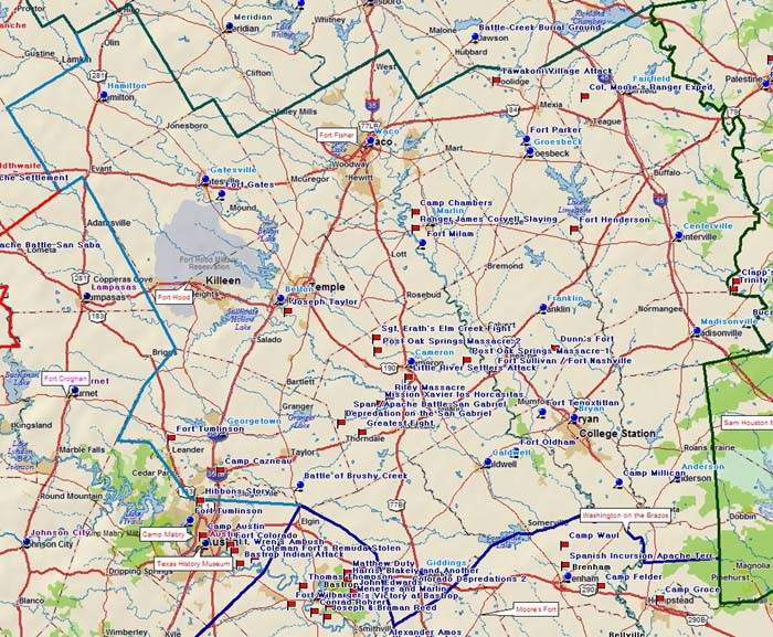
Battle of Brushy Creek | Bucareli | Camp Cazneau | Camp Chambers | Coryell, Ranger James Slaying | Sgt. Erath's Elm Creek Fight | Fort Fisher | Fort Gates | Fort Henderson | Fort Hood | Fort Milam | Fort Oldham | Fort Parker | Fort Sullivan/Fort Nashville | Fort Tenoxtitlan | Fort Tumlinson | Greatest Fight | Little River Settlers Attack | Mission Xavier Los Horcasitas | Col. Moore's Ranger Expedition | Post Oak Springs Massacre-1 | Post Oak Springs Massacre-2 | Riley Massacre | Spanish-Apache Battle on the San Gabriel | Tawakoni Village Attack | Taylor, JosephBrazos Valley Road TripBlood Trails | Northeast Texas | Southeast Texas
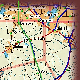
Move your cursor across the map above to select a county in which you are interested.
| ||||||||||||||||||||

 Texas Brazos Trail Region

 |
 |
Fossil Rim Wildflife Park |
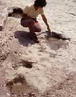
Dinosaur Valley State Park |
Fort Parker State Park offers excellent public camping facilities around the magnificently reconstructed replica of the historically important family stockade. This is the site of the beginning of the forty-year Texas/Comanche War.
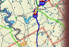
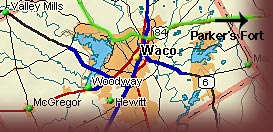
Don't miss the Texas Ranger Museum at Fort Fisher in Waco, right next to the Brazos River on I-35. Waco seems to be the repository of many culinary traditions including the home of Dr. Pepper, and at least at my last visit, it boasted a Leslie's Fried Chicken Stand and Underwood's Barbecue cafeteria.
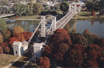
Bridge Over Brazos in Waco
The Brazos River is truly mighty by the time it reaches Waco and is an attraction in itself. The area is home to the Waco band of Wichita Indians; the occasional victims of passing Spanish armies since the 1600s. This was also the location of the wild horse corrals built by American adventurer Philip Nolan in the late 1700s. He and his men fell victim in 1801 to a Spanish army sent to rid the countryside of American filibusters, the term for a land-bound buckaneer or pirate. A third of a century later the trespassing Americans called themselves "Texians" and formed a Republic which authorized the establishment of Torrey's Trading Post on this part of the Brazos. This act encouraged settlement but as the frontier grew to the northwest, many pioneers accused the trading post of providing alcohol and weapons to the raiding Indians.
Download the Texas Brazos Trail Brochure or click here for a viewable Brazos Trail Brochure page
Home | Table of Contents | Forts | Road Trip Maps | Blood Trail Maps | Links | PX and Library | Contact Us | Mail Bag | Search | Intro | Upcoming Events | Reader's Road Trips Fort Tours Systems - Founded by Rick Steed |